Friday, July 23, 2010
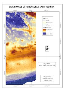
MODULE 5. LIDAR
Although I regret not being able to learn much more about using IMAGINE, it is a relief to be back in the more familiar environment of ARCGIS. And much faster too. This lab was straightforward and took half the estimated time to complete, rather than double.


Tuesday, July 20, 2010
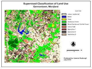
MODULE 4. Supervised Classification

After completing the supervised classification, I combined several classes to simplify the legend. I combined only two of the 4 agriculture classes as they had relatively different spectral signatures, but combined all the urban signatures as well as the fallow fields. Some of the roads seem to have been classified as agricultural land or fallow fields.
Link to xps file
Wednesday, July 14, 2010
MODULE 3. Rectification
Working with imagery is desperately slow on a remote desktop, which is a challenge in itself. I'm assuming its just my very sloooooowww connection here in Africa ....... So no bells and whistles in these labs, just the basics.
Link to map in xps format
Link to map in xps format
Subscribe to:
Comments (Atom)